TL;DR: Monterey County deputies placed Zone MRY-F035 under an evacuation order and Zones MRY-F033 and MRY-F034 under evacuation warnings for the Plaskett Fire near Big Sur.
Order and warnings in effect for Plaskett area
Effective immediately, the Monterey County Sheriff's Office issued an evacuation order for Zone MRY-F035 and evacuation warnings for Zones MRY-F033 and MRY-F034 for the Plaskett Fire, according to the Monterey County update carried by PublicNow.
The county logged the action with a date and time of Aug. 27, 2026, at 1545 hours, and the PublicNow distribution record shows Aug. 28, 2026, at 09:39.
The listed location was the Plaskett Area, Big Sur, Monterey County, California, and the listed media contact was Commander Joseph Bañuelos at 831-755-3771 and [email protected].
The county pointed residents to AlertMRY.org/map for the zone map and to alertmry.org/alerts for additional alert information.
In that county message, an evacuation order meant residents should leave the area now because of an immediate threat to life and property.
In the same message, an evacuation warning meant residents should assume an evacuation order could follow and use the period to get ready and prepare, especially people who need extra time or assistance to leave.
The update was published in English and Spanish, with the Spanish text giving the same zones, map address and alert address for households that use Spanish.
Where the fire started and how large it was
The Plaskett Fire was first reported shortly after 11 a.m. off Forest Road 23S10, east of Los Burros Road near the community of Plaskett, according to CBS San Francisco.
CBS San Francisco reported that as of 5:59 p.m. Thursday, the fire had burned 140 acres with 0% containment.
By Friday afternoon, the reported size was much larger. Bay City News Service, published by SFGate, reported that the Plaskett Fire had grown to 2,774 acres with no containment, according to Cal Fire officials.
KCBX similarly reported Friday afternoon that the Plaskett Fire had grown to more than 2,700 acres in southern Big Sur, threatening properties and prompting evacuation orders and warnings.
The cause of the fire had not been determined, CBS San Francisco reported.
The agency having jurisdiction was identified separately in the CAL FIRE incident record as the U.S. Forest Service for Los Padres National Forest, with the location listed as Forest Road 23S10, east of Los Burros Road, Plaskett.
Additional zones named in Thursday reporting
The county's Aug. 27 update named one order zone and two warning zones.
Separate Thursday reporting described a wider set of zones around the same incident. CBS San Francisco reported evacuation orders for zones MRY-F035 and MRY-F036, and evacuation warnings for zones MRY-F033, MRY-F034 and MRY-F037, with a link to view the evacuation zone map.
Households should treat the Sheriff's Office zone list as controlling for their address and use the county map to confirm whether they are in MRY-F033, MRY-F034, MRY-F035 or a neighboring zone.
The difference shows why residents should check the live county map rather than rely on a zone number remembered from an earlier message.
People who need more time to leave, who use medical equipment, who care for children or older adults, or who need to move animals were specifically described in the county message as people who should use a warning period to prepare.
Terrain, weather and fire behavior
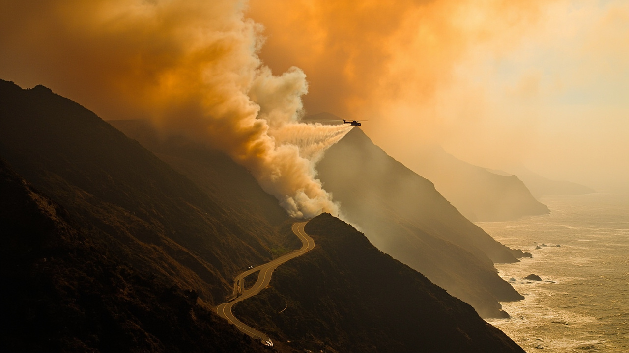
The Plaskett Fire was burning in steep, rugged terrain east of Los Burros Road near the unincorporated southern Monterey County community of Plaskett, Bay City News Service reported.
The outlet quoted Cal Fire's assessment that fire activity continued to present access challenges for ground resources, with crews working from available roads, ridgelines and other strategic locations.
KCBX reported that the fire was burning through steep, rugged terrain east of Los Burros Road and that growth had brought it closer to nearby structures.
According to KCBX, fire crews said the fire remained relatively quiet overnight as light rain and cooler conditions moved across the area.
U.S. Forest Service spokesperson Lee Beyer told KCBX that conditions were expected to change during the day. KCBX quoted Beyer saying there was more cloud cover and very light precipitation across most of the fire areas in the morning, which would help keep growth down for a time, before clearing and increasing fire activity.
Beyer also told KCBX that structure protection and assessment were occurring, and that crews would do what they could to save life and property in that order in a remote and rugged area.
Crews, aircraft and structure work
Firefighters from various agencies including the U.S. Forest Service, CAL FIRE and local government were aggressively moving ground crews and heavy equipment to the perimeter in Monterey County to establish containment lines, CBS San Francisco reported, citing officials.
Specialized Hotshot crews were working to gain access to the fire's edge, while eight air tankers had been requested to assist ground personnel with targeted retardant drops, according to the same CBS San Francisco report.
CAL FIRE's Tulare Charlie Strike Team had been deployed to Los Perros Road to assist about 30 residents, lead evacuation efforts and prepare homes for structure defense, CBS San Francisco reported.
Firefighters were also carrying out evacuations along Burro Road, where five to eight structures could be threatened, according to CBS San Francisco.
KCBX reported that limited access had forced some firefighters to hike several miles to help contain the Plaskett Fire.
KCBX also reported that crews were using bulldozers to remove brush that could fuel the fire, helicopters to drop water on the blaze, and drones in the operation.
Highway 1 closure and second fire nearby
The fire forced closure of Highway 1 between Old Coast Road at mile marker 50.1 to the north and just north of Gorda at mile marker 10.2 to the south, CBS San Francisco reported.
Bay City News Service gave the same closure points, describing the closure as running from about a mile south of Old Coast Road at Mile Marker 50.1 north of the fires to a point a little north of the unincorporated community of Gorda at Mile Marker 10.2 to the south.
KCBX reported that Highway 1 remained closed in the Big Sur area and encouraged drivers to check the CalTrans QuickMap webpage for highway closure updates.
The Plaskett Fire was burning about 20 miles south of the Timber Fire, which started in Los Padres National Forest on the night of Aug. 8, according to CBS San Francisco.
CBS San Francisco reported that as of Thursday afternoon, the Timber Fire had burned 19,296 acres and was 21% contained, with more than 660 structures threatened.
By Friday afternoon, Bay City News Service reported the Timber Fire had grown to a little over 23,300 acres and was at 21% containment.
No injuries or deaths had been reported from either fire, Bay City News Service reported, while the Timber Fire was threatening about 660 structures, according to Cal Fire.
What households should do now
Leave immediately if your zone is under an evacuation order.
Do not wait to see smoke, confirm flames, gather extra supplies or check with neighbors first when the county says the threat to life and property is immediate.
If your zone is under a warning, prepare to leave quickly and assume an order could follow, based on the county's warning language.
Confirm your zone at AlertMRY.org/map and review current alerts at alertmry.org/alerts, the two addresses listed in the county update.
Bay City News Service also listed https://www.readymontereycounty.org/emergency/incident-archive/2026-timber-fire as a place to check current evacuation orders, warnings and shelter-in-place orders.
An evacuation center was set up in the Carmel Mission Inn's conference room at 3665 Rio Road in Carmel, according to Bay City News Service.
People heading toward that center or traveling around Big Sur should expect traffic controls and delays and should budget extra travel time, particularly where Highway 1 is closed and crews and equipment are working.
Sources referenced
- Monterey County, CA (via Public) / Update to Plaskett Fire Evacuation Order and Warnings (https://www.publicnow.com/view/F8A989E4D0260CB95C01BDBF27FD5ED0A26E6DAC)
- Plaskett Fire grows in California's Big Sur just south of Timber Fire; evacuations ordered - CBS San Francisco (https://www.cbsnews.com/sanfrancisco/news/plaskett-fire-big-sur-california-timber-fire-monterey-county/)