TL;DR: Monterey County split zones MRY-F037 and MRY-F038 into A and B sections on Sept. 8, downgrading MRY-F037-A and MRY-F038-A to evacuation warnings while orders stay in force for MRY-F037-B and MRY-F038-B.
Monterey County's 3 p.m. update on Sept. 8 changed the evacuation map for the Plaskett Fire without ending the emergency along Highway 1. According to the county publication titled MEDIA RELEASE - UPDATED EVACUATION ORDERS/WARNINGS FOR PLASKETT FIRE, the Monterey County Sheriff's Office divided two larger zones into four smaller zones to reflect conditions around Los Burros Road. The two southern and eastern pieces moved to a lower alert level, while the two B zones kept mandatory orders. The same release moved the Highway 1 closure point and kept Tree Bones Campground closed.
What changed in the 3 p.m. evacuation update
The Monterey County Sheriff's Office split Evacuation Zones MRY-F037 and MRY-F038 tied to the Plaskett Fire. According to MEDIA RELEASE - UPDATED EVACUATION ORDERS/WARNINGS FOR PLASKETT FIRE, dated Sept. 8 at 3:00 p.m., the reconfigured map created MRY-F037-A, MRY-F037-B, MRY-F038-A and MRY-F038-B.
The release identified MRY-F037-A and MRY-F038-A for a downgrade from an evacuation order to an evacuation warning. Those two zones cover ground south of Los Burros Road and east of Highway 1 in Monterey County, California.
The order level did not lift across the divided area. The release stated that the evacuation order remains in place for MRY-F037-B and MRY-F038-B. Residents assigned to a B zone therefore remained under the higher-level directive after the afternoon revision.
The county listed Commander Andres Rosas as media contact at 831-261-5492 and [email protected]. It directed residents to alertmry.org/alerts for additional information.
Where the order and warning lines sit
The split gives households a more precise zone label to check before acting. According to the KSBW report titled Big Sur Timber Fire still active after one month - KSBW, updated at 3:44 p.m. PDT on Sept. 8, 2026, zones MRY-F037-A and MRY-F038-A were downgraded from evacuation orders to evacuation warnings.
That report placed the downgraded zones south of Los Burros Road and east of Highway 1, matching the county release. It separately confirmed that evacuation orders remained in effect for MRY-F037-B and MRY-F038-B.
The distinction matters for household planning because an order and a warning call for different immediate actions. The county release used the terms Evacuation Order and Evacuation WARNING in capital letters to separate the two levels. People in the A zones moved to warning status, while people in the B zones stayed under order status at the time of publication.
Residents were advised to verify their assigned zone through official county alert channels. The county release pointed to alertmry.org/alerts, while fire information channels also encouraged residents to know their zone through Genasys Protect in related morning incident material.
Highway 1 closure moves to mile marker 10.5
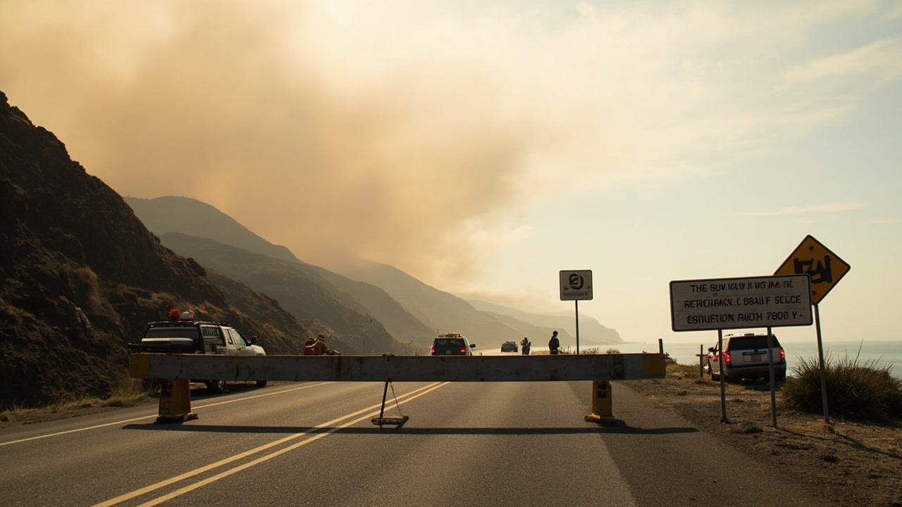
Highway access did not reopen with the partial downgrade. According to MEDIA RELEASE - UPDATED EVACUATION ORDERS/WARNINGS FOR PLASKETT FIRE, the Highway 1 closure will be moved to mile marker 10.5.
KSBW added location detail for drivers, reporting that the southern Highway 1 closure will be moved to mile marker 10.5 near the Willow Springs Caltrans Yard, according to CHP Monterey. That reference point helps travelers and supply runners orient along the Big Sur coast.
Tree Bones Campground also stayed closed. The county release stated that Tree Bones Campground will NOT open as a result of this change. KSBW likewise reported that Treebones Campground will not reopen as a result of the evacuation changes.
Residents were advised to check the latest evacuation information and road conditions before traveling in the area. That travel check is especially important where closure points can shift during active operations.
Plaskett Fire size, start point and containment
The evacuation adjustment arrived as containment improved on the Plaskett Fire. According to KSBW, the Plaskett Fire had burned 29,862 acres and was 47% contained in a Tuesday update.
The same report said the Plaskett Fire began Aug. 26 near Forest Road 23S10, east of Los Burros Road. Its cause remained under investigation.
Fire officials described continued work on direct and indirect control lines. KSBW quoted the Tuesday operational picture as crews continuing to strengthen those lines while securing areas of previous growth.
Strategic firing operations and aviation support continued to assist containment efforts. Resources also continued work to connect containment lines along the eastern portion of the incident.
Steep, rugged terrain and limited access remained operational challenges, according to CAL FIRE in the Tuesday update carried by KSBW. Structure defense remained the priority.
Timber Fire marks one month nearby
A second fire continued burning in the Big Sur area on the same day. According to KSBW, the Timber Fire had been burning for one month and remained active at 25,380 acres with 27% containment in the Tuesday update.
The Timber Fire began Aug. 8 southeast of Loma Vista. Its cause remained under investigation.
Fire behavior was primarily backing and flanking, although localized uphill runs remained possible, according to CAL FIRE. Isolated heat sources continued to reignite as conditions became warmer and drier.
Fire officials identified the northwest portion as the highest threat to values at risk. The majority of the western perimeter along Highway 1 remained in mop-up and patrol status.
Resources continued improving handlines, dozer lines, hoselays and sprinkler systems. Protection of the Highway 1 corridor and surrounding communities remained a priority in related official statements summarized by KSBW and CBS-linked incident summaries.
Personnel and equipment assigned Sept. 8
Staffing levels showed two large responses operating at once. According to KSBW, about 2,177 personnel were assigned to the Plaskett Fire.
That Plaskett assignment included 145 engines, 15 water tenders, 12 helicopters, 31 dozers and 58 hand crews. The figures illustrate the scale of line construction, water supply, air support and ground crew work underway.
The Timber Fire assignment totaled about 1,600 personnel. KSBW listed 70 engines, 32 water tenders, nine helicopters, 24 dozers and 24 hand crews on that incident.
Together, the two fires accounted for tens of thousands of burned acres along the Central California coast. KSBW reported the Timber total at 25,380 acres and the Plaskett total at 29,862 acres.
Both causes remained under investigation. Residents were told to check official evacuation and road information before travel rather than assume conditions had stabilized.
Heat advisory and fire behavior outlook
Weather was expected to make holding and building line more difficult. According to KSBW, CAL FIRE said warming and drying conditions will continue through Thursday, with poor overnight humidity recovery.
A Heat Advisory was in effect Wednesday and Thursday. CAL FIRE said in a Tuesday incident update that warming and drying conditions will continue through that period.
For the Timber Fire, officials said isolated heat sources continue to reignite as conditions become warmer and drier. Localized uphill runs remained possible even where behavior was primarily backing and flanking.
For the Plaskett Fire, CAL FIRE said officials expect warmer and drier conditions the rest of the week. The combination of heat, low humidity recovery and terrain-driven winds can test containment lines.
Households in warning zones should monitor official heat and fire updates closely. People with heat-sensitive family members should include cooling, water and power-outage backup in their immediate plans in general terms.
Shelter, meeting and where to verify zone status
One shelter location was identified for people affected by the fires. According to KSBW, the Santa Rosa Catholic Church at 1174 Main St. in Cambria remained open as a shelter.
A public information session was scheduled for the evening of the evacuation change. KSBW reported that Los Padres National Forest would host a virtual community meeting about the Plaskett Fire at 6 p.m. Tuesday, Sept. 8.
Representatives from California Interagency Incident Management Team 7, Los Padres National Forest, Fort Hunter Liggett Fire Department and other cooperating agencies were expected to provide updates. The meeting was to be broadcast on the California Team 7 YouTube page, the Los Padres National Forest Facebook page and the California Team 7 Facebook page.
A Spanish-language broadcast was also to be available on the California Team 7 Facebook page. That option matched the county's bilingual release, which carried the zone-split details in English and Spanish.
For household verification, the county release listed alertmry.org/alerts. KSBW likewise advised residents to check the latest evacuation information and road conditions before traveling in the area.