Cyrus Fire in Kernville Triggered Evacuation Warning After 20-Acre Start
TL;DR: The Cyrus Fire started near Cyrus Canyon Road and Sierra Way on Friday afternoon, Oct. 9, 2026, and Kern County officials set a Level 2 evacuation warning for Zone KRN-761 after it was reported at 20 acres.
What happened on Oct. 9
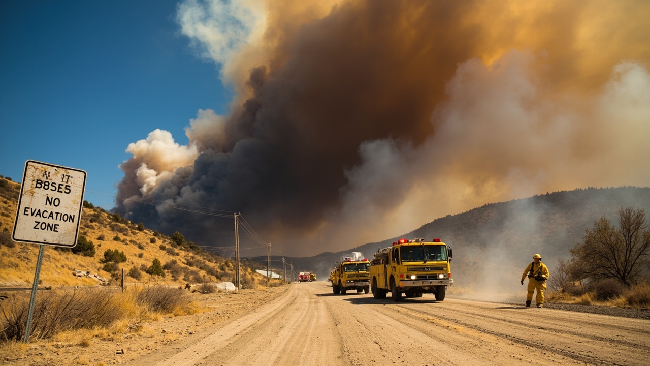
A brush fire named the Cyrus Fire broke out in the Kernville and Lake Isabella area of Kern County, California, on Friday afternoon, Oct. 9, 2026. According to KGET, the Kern County Fire Department reported the fire at 20 acres, prompting an evacuation warning.
The initial location was given as the area of Cyrus Canyon Road and Sierra Way. According to KGET, citing Watch Duty, the outbreak occurred just after 2 p.m. Friday. That intersection sits in a mountain community corridor between Kernville, Wofford Heights and Lake Isabella, east of Sierra Way and near the Kern Valley Airport, a geography later described in reports from BakersfieldNow.
The cause was unknown, according to the Kern County Fire Department as reported by KGET. No information on injuries was available in the early reporting, and a later account from TurnTo23 stated there was no word on any injuries so far.
What began as a 20-acre report did not stay small. Later Friday information cited by BakersfieldNow put the fire at 327 acres, according to CalFire. A separate later account from TurnTo23, citing Watch Duty, placed the estimate at approximately 370 to 400 acres. The Kern County Fire Department described movement at a moderate rate of spread with wind shifts, according to BakersfieldNow. Air Attack assessed that the fire had jumped the upper portion of Cyrus with potential for 1,000 acres, according to TurnTo23.
Where the evacuation warning applied
The first formal protective action was a Level 2 evacuation warning for Zone KRN-761. According to KGET, the warning was set after the 20-acre report in Kernville.
A county emergency message distributed through ReadyKern and the Kern County Office of Emergency Services gave the same zone and general location. According to Forth emergency alerts, the Kern County Sheriff issued a wildfire evacuation warning for Zone KRN-761 near northeast of Lake Isabella at 2:32:26 p.m. PDT on Oct. 9, 2026, for an area centered on Kernville.
That alert warned that visibility in the area would be reduced and roads could become blocked. It told residents to prepare to leave, to call 9-1-1 if they or others had an emergency, and to check Facebook.com/ReadyKern for updates, according to Forth.
For households, the zone number mattered more than a street name. Kern County uses numbered evacuation zones published through Genasys Protect, and later Friday updates continued to reference KRN-761 alongside neighboring zones. Residents were directed to confirm their own zone through county tools rather than relying on smoke location alone.
How the order and additional warnings expanded
By Friday afternoon, the protective actions escalated. According to BakersfieldNow, Genasys Protect showed an evacuation order for KRN-761, covering the area east of Sierra Way near the Kern Valley Airport. The outlet reported that those in the evacuation order faced an immediate threat and must leave.
According to BakersfieldNow, an evacuation warning was also issued for KRN-760-B and KRN-768. People in those warning zones faced a potential threat to life and property. TurnTo23 gave the same structure: an evacuation order for KRN-761 and an evacuation warning for KRN-760-B and KRN-768, according to Genasys Protect.
The distinction is important for preparedness planning. Background reporting from Herebeat on California wildfire alerts explains that California uses standard statewide terms, with an evacuation warning meaning a potential threat and time to get ready, and an evacuation order meaning an immediate threat and a lawful order to leave. County sheriffs and local officials issue those evacuation decisions, while fire agencies report incident name, size and containment, according to Herebeat.
In this incident, the practical effect was a core order zone surrounded by warned zones. Residents in nearby Lake Isabella told TurnTo23 they were watching closely because they were downwind, even though no evacuation order had been issued for any other area at that time, according to TurnTo23.
Shelter, animals and help getting out
Officials opened a public shelter during the Friday response. According to TurnTo23, an evacuation center was set up at Kern Valley High School at 3340 Erskine Creek Road, Lake Isabella, CA 93240.
Animal sheltering was addressed at the same location. According to TurnTo23, Animal Services would assist with sheltering companion animals at the center. That detail matters for households that delay leaving because they do not want to leave pets behind.
Help with movement limitations was also announced. According to TurnTo23, people with physical limitations who needed evacuation help could call the Aging and Adult Services hotline at 1-855-264-6565. The same report cautioned that assistance might not be guaranteed after 9:30 p.m. For people with access, functional and special needs, sheltering equipment was available at open shelters, according to TurnTo23.
These were time-sensitive offers, not open-ended guarantees. The note about a nighttime limit on evacuation-help availability underscores a preparedness lesson repeated in many California incidents: arrange transportation, backup drivers, and neighbor check-ins before smoke reduces visibility and blocks roads.
Fire behavior reported Friday
Early spread was described as pushing east with a moderate rate of spread and a structure threat. By mid-afternoon, crews were dealing with wind shifts, according to BakersfieldNow citing the Kern County Fire Department.
The fire later jumped the upper portion of Cyrus Canyon, according to TurnTo23 citing Air Attack, which estimated potential growth to 1,000 acres. That potential figure was an assessment of what could happen, not a report that 1,000 acres had burned by that point.
Containment was reported as none in the early phase. According to BakersfieldNow, CalFire reported the Cyrus Fire at 20 acres with no containment in its initial item. Later size estimates grew through the afternoon and evening, reaching 327 acres in the BakersfieldNow update and approximately 370 to 400 acres in the TurnTo23 update citing Watch Duty.
Unified command information was not fully detailed in the local news summaries available that day, but the incident involved county and federal-area interests near Sequoia National Forest lands south of Kernville. Households should treat all acreage figures from Oct. 9 as snapshots tied to specific times, because fast-moving fires are commonly remapped as aircraft and ground crews report new perimeters.
What Kern River Valley households should take from this day
The Cyrus Fire timeline shows how quickly a reported 20-acre start can generate zone-based orders, road concerns and shelter openings within hours. The first warning for KRN-761 came the same afternoon as ignition, followed by an order for that zone and warnings for two adjacent zones.
For self-reliance, the key steps highlighted by the official messages were simple: know your evacuation zone in advance, prepare to leave when a warning is issued, leave immediately when an order is issued, and do not wait for visibility to worsen. The ReadyKern alert specifically warned about reduced visibility and blocked roads, according to Forth.
Households with extra time needs — older adults, people with disabilities, families with small children, and homes with pets or livestock — benefit most from leaving at the warning stage. The county provided a hotline and shelter equipment, but also attached time limits and capacity conditions, according to TurnTo23.
Finally, information discipline mattered. Officials pointed residents to ReadyKern on Facebook, Genasys Protect for zone status, and 9-1-1 for emergencies. Checking a fire map alone does not confirm whether a specific address is under an order. Only the county alert or official evacuation map can answer that, as explained in general guidance from Herebeat. On Oct. 9, that meant verifying KRN-761, KRN-760-B and KRN-768 status directly before deciding to stay or go.