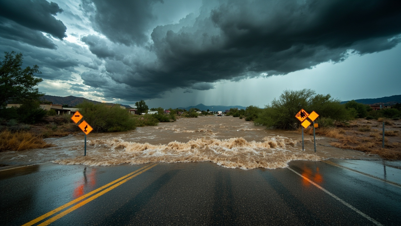
TL;DR: The National Weather Service in Tucson kept a flash flood warning for east-central Pima County until 4:15 p.m. MST on September 12, 2026, after radar showed heavy rain over Vail and Tucson's east side.
Warning window and radar trigger
The warning covered East Central Pima County in southeastern Arizona and ran until 415 PM MST, according to the report titled Flash Flood Warning issued September 12 at 1:21PM MST until September 12 at 4:15PM MST by NWS Tucson AZ.
At 121 PM MST, Doppler radar indicated thunderstorms producing heavy rain across the Vail area, with another area developing across the east side of Tucson.
Between 0.75 and 1.5 inches of rain had fallen in the Vail area at the time of that bulletin.
Additional rainfall amounts up to 1 inch were possible in the warned area.
Flash flooding was described as ongoing or expected to begin shortly.
The listed hazard was flash flooding caused by thunderstorms.
The listed source was radar indicated.
The listed impact was flash flooding of small creeks and streams, urban areas, highways, streets and underpasses as well as other poor drainage and low-lying areas.
The bulletin was issued by NWS Tucson AZ for Pima County, AZ.
Communities named in the warning
Some locations that were expected to experience flash flooding included Tucson.
Davis-Monthan Air Force Base was included among locations expected to experience flash flooding.
Tanque Verde was included among locations expected to experience flash flooding.
Vail was included among locations expected to experience flash flooding.
Saguaro National Park East was included among locations expected to experience flash flooding.
Rita Ranch was included among locations expected to experience flash flooding.
Broader Saturday coverage also involved East Central Pima and North Central Santa Cruz Counties, according to the KVOA report titled Active thunderstorms today in Southern Arizona.
That KVOA report, written by John Macaluso on Sep 12, 2026, listed Tucson, Oro Valley, Nogales, Vail, and Marana in connection with the warnings in effect that afternoon.
The same KVOA report said areas were under different warnings, but all should expire by 4:30 P.M. Saturday.
Highways placed inside the flood risk
Interstate 10 between mile markers 268 and 289 was included in the flash flood warning.
Route 83 between mile markers 53 and 58 was included in the flash flood warning.
Residents using Interstate 10 through the Tucson-Vail corridor therefore had a named highway segment inside the warned area.
Travelers using Route 83 through the southeastern approach also had a named highway segment inside the warned area.
The warning urged people not to drive on flooded roads and to find an alternate route.
It also stated the national safety phrase “Turn around, don’t drown” when encountering flooded roads.
It stated that most flood deaths occur in vehicles.
It instructed people to be aware of surroundings and not to drive on flooded roads.
It warned that hilly terrain contains hundreds of low water crossings which are potentially dangerous in heavy rain.
It instructed people not to attempt to cross flooded roads.
Low-water crossings singled out by forecasters
Harrison Rd at Pantano Wash was listed as a flash flood prone location.
Agua Caliente Wash from Soldier Trl to Fort Lowell was listed as a flash flood prone location.
Wentworth Rd at Tanque Verde Wash was listed as a flash flood prone location.
Tanque Verde Loop Rd at Tanque Verde Wash was listed as a flash flood prone location.
Old Spanish Trl at Rincon Creek was listed as a flash flood prone location.
Houghton Rd from I-10 and Sahuarita Rd was listed in the warning’s prone-location inventory.
Escalante Rd at Atterbury Wash was listed as a flash flood prone location.
Alamo Wash between Speedway and Grant was listed as a flash flood prone location.
Andrada Rd east of Wentworth Rd was listed as a flash flood prone location.
Camino Loma Alta at Rincon Creek was listed as a flash flood prone location.
Freeman Rd between Broadway and Old Spanish Trail was listed as a flash flood prone location.
Old Spanish Trail at Jeremy Wash was listed as a flash flood prone location.
Calle Rinconada Rd from Andrada Rd to Sahuarita Rd was listed as a flash flood prone location.
Households near those crossings needed to treat pavement over a wash as a possible waterway during the warning period.
People who normally use Old Spanish Trail, Houghton Road, Harrison Road, Wentworth Road, Escalante Road, Freeman Road, Andrada Road, and Calle Rinconada Road had specific intersections called out for caution.
People traveling Speedway to Grant across Alamo Wash, and Soldier Trail to Fort Lowell along Agua Caliente Wash, likewise had named segments inside the alert.
Creeks, rivers and washes under watch
Ventana Canyon Wash was listed among streams and drainages in the warning.
Santa Cruz River was listed among streams and drainages in the warning.
Rincon Creek was listed among streams and drainages in the warning.
Cienega Creek was listed among streams and drainages in the warning.
Tanque Verde Wash was listed among streams and drainages in the warning.
Rillito River was listed among streams and drainages in the warning.
Chico was listed among streams and drainages in the warning.
Arroyo was listed among streams and drainages in the warning.
Sabino Creek was listed among streams and drainages in the warning.
Mescal Arroyo was listed among streams and drainages in the warning.
Coyote Wash was listed among streams and drainages in the warning.
Agua Verde Creek was listed among streams and drainages in the warning.
Pantano Wash was listed among streams and drainages in the warning.
The breadth of that drainage list showed why urban streets, underpasses, small creeks, and poor-drainage low spots were all mentioned together.
A household does not need to live beside a major river to face risk when many neighborhood washes can rise quickly.
Severe thunderstorms alongside the flood threat
A separate severe thunderstorm warning covered East Central Pima County and North Central Santa Cruz County until 145 PM MST on September 12, 2026.
At 106 PM MST, a severe thunderstorm was located 9 miles southeast of Green Valley, and that storm was stationary.
The hazard was 60 MPH wind gusts and small hail, with radar indicated as the source.
The expected impact was damage to roofs, siding, and trees.
Locations impacted included Sahuarita, Green Valley, Amado, Madera Canyon and Arivaca Junction.
That severe storm bulletin included Interstate 19 between mile markers 25 and 42.
It also included Route 83 near mile marker 44.
Another severe thunderstorm warning covered East Central Pima County until 230 PM MST.
At 150 PM MST, that severe thunderstorm was located near Green Valley and was moving southeast at 10 MPH.
Its hazard also was 60 MPH wind gusts and small hail.
Locations impacted included Sahuarita, Green Valley and Arivaca Junction.
That later bulletin included Interstate 19 between mile markers 31 and 46.
Protective advice in the severe storm bulletins said to seek shelter inside a well-built structure and stay away from windows.
The bulletins said the storms were capable of producing damaging winds.
They noted continuous cloud to ground lightning and warned that lightning is one of nature’s leading killers.
They said people close enough to hear thunder are close enough to be struck by lightning.
They also warned that torrential rainfall was occurring and could lead to flash flooding, and told drivers not to take vehicles through flooded roadways.
Weekend weather pattern for prepared households
The KVOA StormTracker 4 forecast described a major weather shift with rising storm chances and falling temperatures.
It said rain and cooler air were expected to stay in southern Arizona over the next several days.
It said scattered storms with frequent lightning would continue to evolve through the afternoon, with heavy rainfall as the main concern.
It added that strong gusty outflow winds could not be ruled out.
It said wet weather would stick around for the weekend and into next week.
For Monday, it forecast afternoon showers and thunderstorms with a high of 95 degrees and a low of 76 degrees.
That multi-day outlook meant Saturday’s warning was not an isolated shower but part of a longer unsettled stretch.
Households in Tucson, Vail, Oro Valley, Marana, and Nogales therefore faced repeated chances for rapid water rises rather than a single short event.
What to do before water covers a road
Do not enter a flooded intersection listed in the warning, including wash crossings on Harrison, Houghton, Wentworth, Escalante, Freeman, Andrada, Old Spanish Trail, and Calle Rinconada.
Leave earlier when Interstate 10 mile markers 268 to 289 or Route 83 mile markers 53 to 58 are in a flash flood warning.
Park away from small creeks, underpasses, and low-lying poor-drainage spots named in the impact statement.
Keep flashlights, charged phones, drinking water, medications, and important papers ready to move to higher ground inside the home.
Check on neighbors near Rincon Creek, Tanque Verde Wash, Pantano Wash, Cienega Creek, Sabino Creek, Rillito River, and other listed drainages.
During severe thunderstorms near Sahuarita and Green Valley, move inside a well-built structure and stay away from windows.
Take lightning seriously when thunder is audible, because federal guidance treats audible thunder as close enough for a strike.
After the warning period, continue checking weather.gov and local outlets because KVOA forecast additional weekend and next-week storm chances.
Sources referenced
- Active thunderstorms today in Southern Arizona | StormTracker 4 Weather Headquarters (https://www.kvoa.com/weather/active-thunderstorms-today-in-southern-arizona/article_5e52a476-7a37-473f-9384-49d0de55e1e4.html)